Plan a routePLEN

Warsaw Metro map

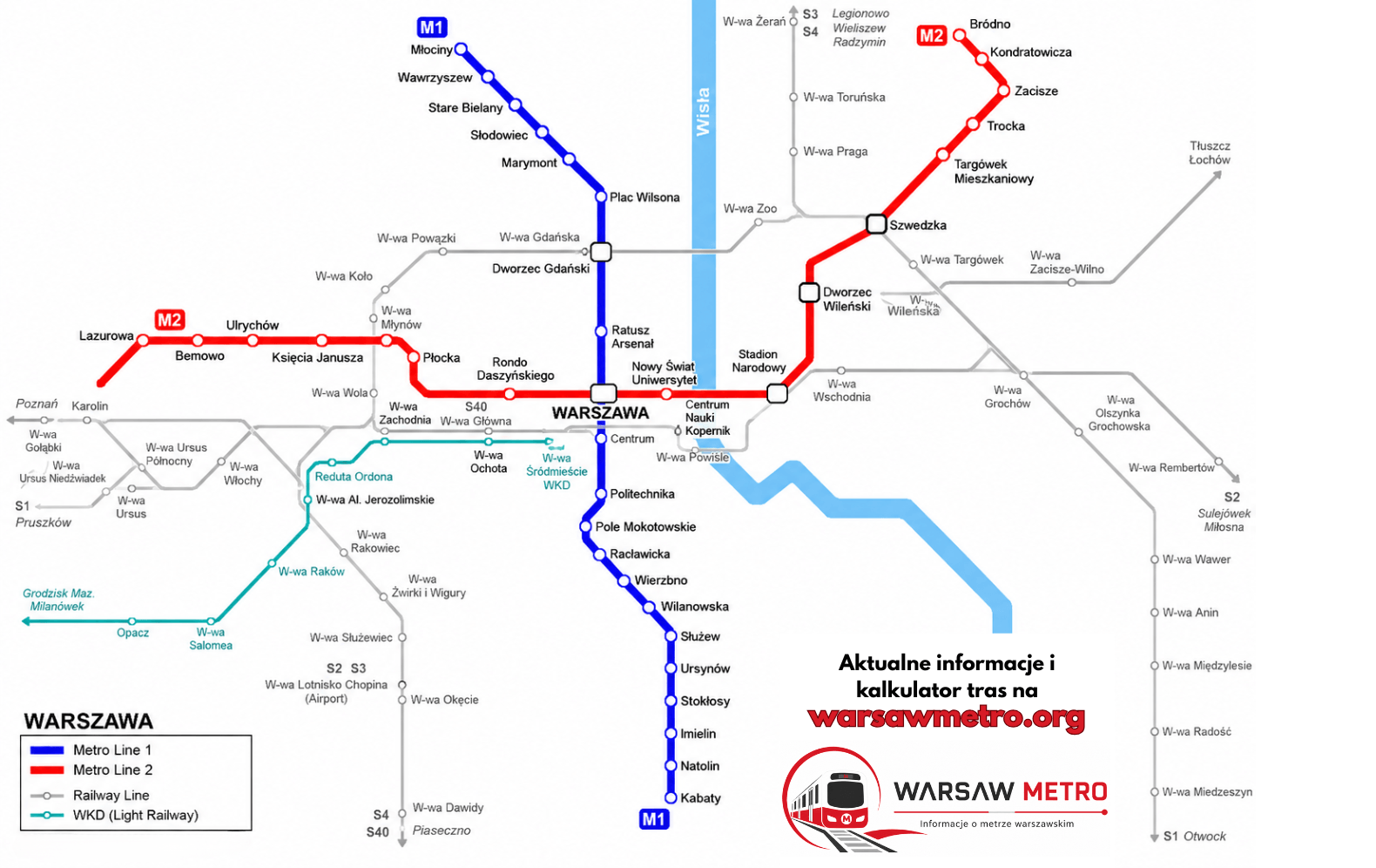
The whole network on one map — 2 metro lines and 38 stations. Download the map below as PNG or PDF.

Information updated: august 2026

Map of the Warsaw Metro lines

Warsaw Metro network map — lines M1, M2 and the interchange station

The map shows both metro lines and connections with ZTM trams and buses. For the current official map, visit metro.waw.pl. Source: official Metro Warszawskie network map.

Warsaw Metro map in PDF — download

Download the current Warsaw Metro map as a PDF — it stays sharp when printed or zoomed in and works offline: both lines, 38 stations and the interchange, all at hand even without an internet connection.

Lines and their colours

Młociny ↔ Kabaty
21 stations · Blue
Bemowo ↔ Bródno
18 stations · Red

Interchange station

At the interchange station you move between lines through internal corridors without leaving the paid zone. The Warsaw Metro has one interchange hub: Świętokrzyska (M1+M2).

Frequently asked questions

The network has 38 stations and 2 lines — about 42 km of track. The map also marks connections with ZTM trams and buses.

Right here on this page — click the “PDF map” button and the file will save to your device. The map is also available as a PNG. Both versions are free, print-friendly and work offline.

Świętokrzyska connects lines M1 and M2 in the heart of the city, near the Palace of Culture and Science. It is the only interchange station on the Warsaw Metro.

Yes, the map shows the current layout of both lines — M1 and M2. Check metro.waw.pl before you travel for any last-minute changes.

Contents